Development clustered within the city limits of Reno and Sparks, still separated by miles of open land.
Many know 4th Street and Prater Way as the historic route of the Lincoln Highway. This is true, in part. Through the years, the highway followed a number of different paths through the Reno-Sparks area, with the stretch of East 4th Street from Virginia Street to the Asylum road (Galletti Way) serving as the one consistent portion.
Inclusion on the transcontinental route was a coveted prize as America entered the Automobile Age. By 1910, adventurous motor tourists had already begun to travel great distances via automobile, and proponents of the Good Roads movement had long been advocating for better roadways to serve them. With the establishment of the Lincoln Highway Association in the summer of 1913, a continuous, improved coast-to-coast highway finally appeared feasible.
The Lincoln Highway Era Begins
Dedicating the new highway to Abraham Lincoln, the privately funded highway’s organizers announced their chosen route in September of 1913. Locals rejoiced when Reno made the list. As an editorial in the Reno Evening Gazette asserted, “The location of the route through Reno means much to every business interest in the city. Reno will naturally become more than a way-station on the route. It will become, because of its size and location, a supply depot and a scenic feature of the transcontinental trip.”
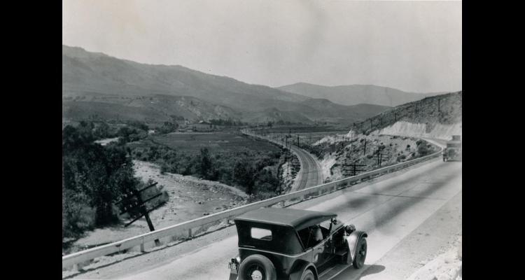
The highway split into two at Reno, with one branch proceeding directly westward to Truckee and an alternate route extending south to Carson City and then over the mountains to Lake Tahoe. Reno may have been a natural choice for a stopover, but Sparks was not. In fact, the initial route bypassed the nascent railroad town entirely, running south of the Truckee River along present-day Glendale Avenue. At some point, the highway detoured north along present-day Vista Boulevard, meeting up with Prater Way and then continuing westward. The most enduring route ran along B Street (Victorian Avenue), veered north at 15th Street, and then headed west on the County Road to Reno.
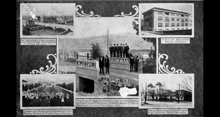
Washoe County lagged behind in marking the transcontinental route, but made two major strides in April 1914. That month, the area’s first Lincoln Highway sign was painted on the side of the Washoe County Bank at Second and Virginia Streets in Reno, and cement contractor A.F. Neidt constructed a concrete bridge on the highway route five miles west of town with carved concrete side rails spelling out the words “Lincoln” and “Highway.” The bridge railings can be viewed today in a truck parking area near Mogul, along eastbound Interstate 80.
The Victory Highway and Early Auto Tourism
The area experienced its first major surge of traffic along the highway in 1915, as hundreds of motor tourists passed through on their way to attend the Panama Pacific Exhibition in San Francisco. With the passage of the first Federal Aid Road Act in 1916 and the formation of the state highway department, the road between Reno and Sparks was improved. Within a few years, it was designated part of a second cross-country highway, the Victory Highway, organized in 1921 to memorialize veterans of World War I. After following a northerly route across Nevada—along the Humboldt River—the new highway converged with the Lincoln Highway all the way from Fernley to Truckee.
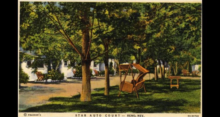
Gradually these developments began to impact the appearance of the corridor, as garages, automobile salesrooms, and related services began to populate the area’s major thoroughfares. The popular new mode of travel also bred new types of accommodations. Most existing area hotels had been built for the railroad traveler—no parking lots needed. In contrast, cross-country auto travelers required affordable facilities with ample space for parking, as well as gasoline, food, and other services. Motor tourists were accustomed to camping alongside their vehicles when no other facilities were available. Closer to populated areas, an early “auto camp” or “tourist camp” might include a pad for pitching a tent, plus a nearby market or service station. Toward the late 1920s, many camps began to feature rustic “cottages” with running water and kitchenettes.
Auto Camps and Auto Courts
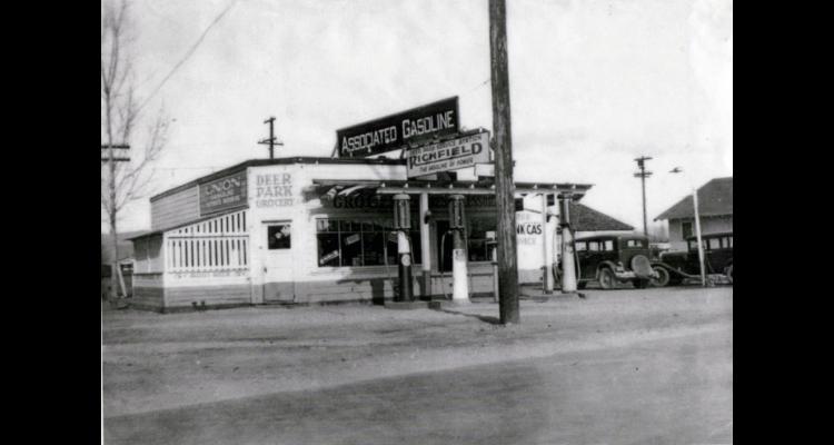
By 1919, Sparks had opened a free municipal auto camp at Deer Park, on Prater Way. Two rows of trees running diagonally through the park provided shade in the warmer months, and by 1924, the site offered a working water pump and a nearby grocery store. Although eventually charging a small fee, the park remained open for tent camping until 1933.
Continuing westward, several other auto camps dotted the roadside from Sparks to Reno. While the Coney Island amusement park had declined after the death of its founder in 1912, the surrounding area took on the resort’s name and several new businesses. In 1924, E.F. Whitton purchased over five acres of the old amusement park and opened the Coney Island Auto Camp. Dubbed “Reno’s best auto park” in 1927 by the California-Oregon-Washington Tourist Association, the site featured cabins, camping spots, electric lights, showers, tourist supplies, a restaurant, and a barber shop.
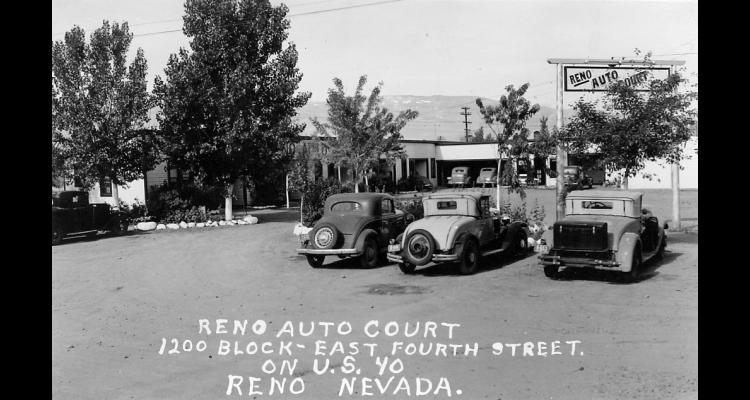
By the mid-1920s, the Coney Island area also boasted Ralph Galletti’s Coney Island Tamale Factory and the Coney Island Dairy, run by John Casale. Less than a mile down the road, poultry farmer Julius Redelius installed a gas pump on his property and opened the Twin City Service Station, which became a full-fledged auto camp with running water and, eventually, cottages. In 1928, the Reno Auto Court opened at Toano Street, near the site of the 1910 Johnson-Jeffries Fight. Out on West 4th Street, tourist cabins included the rustic Silver State Lodge.
The state legislature’s reduction of the required divorce residency period from six months to three months in 1927 further increased demand for temporary housing options, from the established brick hotels on East 4th Street to these new offerings.
Local business leaders decided to capitalize on national enthusiasm for the completion of the Lincoln and Victory Highways by staging a giant Transcontinental Highways Exposition on the grounds of the new Idlewild Park in west Reno. Held in the summer of 1927, the massive event constructed scores of temporary structures throughout the park, attracted countless tourists from across the country, and left a lasting imprint on Reno in the form of the park’s Mission Revival-style California Building and the first permanent Reno Arch.
Two Growing Communities
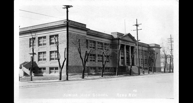
Not all of the action along the corridor revolved around the growing tourist trade; surrounded by residential neighborhoods on both ends, it remained an ideal location for schools. Reno Junior High (later known as Northside Junior High) was built on East 4th Street between Lake and Center in 1924. Further east, Sparks’ original school building on Prater Way got some much-needed relief in 1917 with the construction elsewhere in town of two other schools: the first Sparks High School and Mary Lee Nichols Elementary. The original school was renamed Robert H. Mitchell Elementary when Sparks Junior High School opened adjacent to the high school in 1925.
Although functioning as one continuous roadway, the corridor took on very different characteristics in the vicinities of Reno and Sparks. Increasingly, the entire stretch of County Road within Sparks city limits was referred to as Prater Way, and by the mid-1920s, it remained sparsely developed. Aside from the Deer Park Service Station and the Mitchell School, it had the feel of a peaceful country lane, with well-spaced out houses on large lots and an irrigation ditch running alongside.
Not so in Reno, where early industrial and commercial development had set the tone. Businesses established in the early decades of the century provided continuity, with a few changes in name and ownership. The Nevada Meat Company became the Nevada Packing Company, still operating next door to the Flanigan Warehouse, which remained busy even after Flanigan’s death in 1920. The Nevada-California-Oregon Railroad sold in 1917 to the Western Pacific Railroad, which continued to operate its facilities and elegant depot. Reno Mill & Lumber sold in 1913 to the Verdi Lumber Company and then, in 1928, to A.T. Eveleth, the company’s purchasing agent, who gave the business his name.
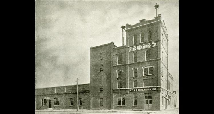
The ratification of the 18th Amendment in 1919 had a major impact on area brewers, including the phenomenally successful Reno Brewing Company, which had continued to expand its facilities on East 4th Street. Even before national Prohibition went into effect in January of 1920, Nevada voters had outlawed the consumption of alcohol, forcing the company to shift production to near beer, soda water, tonics, seltzers, and fruit-flavored soft drinks. Just to the south, the Rainier Brewing Company Bottling Plant also diversified its offerings, never again exclusively distributing beer.
Farewell Streetcar, Hello U.S. 40
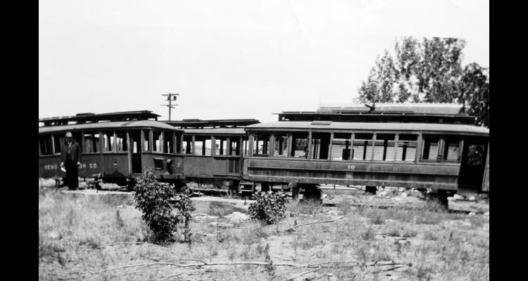
Troubles also plagued the area’s streetcar lines, which struggled for profits in the face of fare caps and rising maintenance costs. In 1919, as the popularity of automobiles soared, the Reno Traction Company ended streetcar service along every line but the popular Reno-Sparks route. Even that was short-lived. In 1927, the company abandoned its final line and introduced intercity commuter bus service, a clear sign that the Automobile Age had fully arrived.
On September 1, 1928, crews of Boy Scouts across the country labored to install approximately 2500 concrete markers along the route of the Lincoln Highway. Each post, designed by the Lincoln Highway Association, featured a bronze medallion with a bust of Abraham Lincoln and a bold “L” on a white background, set off by red and blue stripes. The move was memorial in nature, as the Bureau of Public Roads had just assigned numbers to the nation’s named highways. Nevada’s section of Lincoln Highway became U.S. Route 50, while the Victory Highway, including its length through Reno and Sparks, was designated U.S. 40, the main east-west route from Atlantic City to San Francisco. The stage was set for the area to become a tourist mecca.